Gravity
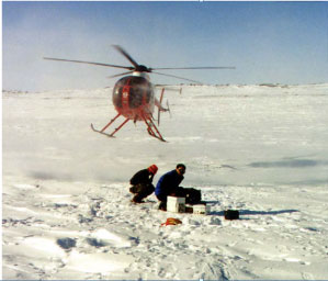 |
LandTech has performed Gravity surveys since 1998. The LandTech team has developed techniques that combine the latest in GPS, Gravity meters and computing technology, to provide accurate and cost-effective surveys. The latest CG5 Scintrex Gravity Meters are used by LandTech.
Our survey operations span the globe, having successfully undertaken major contracts in 9 countries on 5 continents. Thousands of gravity stations have been surveyed. LandTech’s reputation for precision field work is a direct result of the overriding commitment to survey quality by our dedicated staff of internationally experienced surveyors, engineers and gravity technicians. |
The operations of LandTech’s gravity surveys since 1998 have built an impressive list of satisfied clients. We would be pleased to put you in contact with these companies should you wish to have references or referrals.
Joint Inversion of Passive Seismic Tomography MT and Gravity Measurements
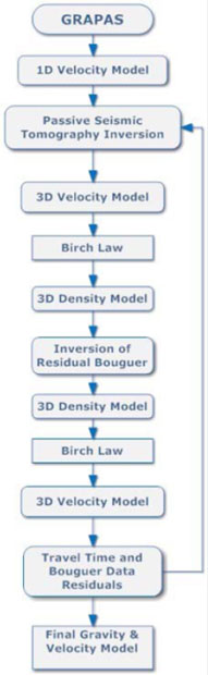
LandTech has developed GRAPAS® a joint Passive Seismic Data and Bouguer gravity residuals inversion. It consists of the reiteration of a set of n iterations of the seismological inversion, leading to a new velocity model and new event locations, followed by one inversion of the gravity data and the computation of a new density contrast model. This procedure is repeated until the convergent criterion is satisfied.
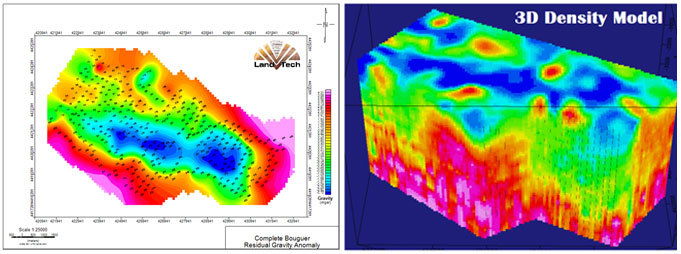
An example of the inversion of Gravity data obtained by LandTech, in a region with high hydrocarbon potential is presented below.
The starting velocity model used for the first inversion of travel time data is the initial 1-D velocity model estimated from the geological characteristics of the region under investigation. The iterative PATOS® program calculates the 3-D Vp model and new earthquake locations from the arrival times of local earthquakes. This process is stopped after n iterations.
This 3-D absolute Vp model is then converted into a 3-D relative density contrast model using Birch’s law. At this stage, the linear inverse gravity problem is solved leading to a new density contrast model that is transformed back to a new Vp model. This completes the first loop of the sequential inversion.
The following loops use the same procedure defining as input the final velocity model of the previous loop. The sequential process is stopped when the standard deviations between observed data and theoretical values calculated from the models stop decreasing significantly between two loops. The density contrast model is computed using the linear stochastic method.
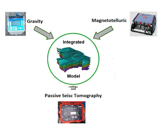
LandTech’s engineers have recently developed GRAMAPAS® a joint inversion program of passive seismic tomography, gravity and magnetotellurics data.
Click here to see the brochure